Planning your full visit? Compare trip lengths and route choices in the Óbidos itinerary planner.
This self-guided route connects the key historic stops without pretending every old stone needs its own map pin. It absorbs the useful intent of the former historical-sites-map page and uses the municipality's current downloadable visitor map.
Allow two to three hours at ground level, longer with museums, shops or lunch. Add the walls only as a separate safety decision in dry, calm daylight.
Download the Official Map First
Turn this guide into a personal route with our free Óbidos itinerary planner.
The municipal visitor map identifies the tourism office, main approach, parking, Porta da Vila, major churches, castle, aqueduct and other practical services. Save the PDF offline because signal can be inconsistent in thick-walled interiors. The tourism office near the main parking area can clarify live hours and temporary closures.
Stop 1: Porta da Vila
Begin outside the gate so you can see how the fortified entrance controls the approach. Inside, pause for the blue-and-white tile decoration without blocking the narrow passage. The polished stone and steps require care when wet.
Stop 2: Rua Direita and a Quieter Parallel Lane
Rua Direita is the commercial spine, but it is not the only route. Walk part of it for shops and street life, then switch to a parallel lane for quieter facades and less crowd pressure. This small loop makes the village feel larger without creating a false list of attractions.
Stop 3: Praça de Santa Maria
The main square anchors the civic and religious center. Check church and museum hours locally rather than assuming every door stays open all day. This is a sensible place for a seated pause before the uphill section.
Stop 4: Literary Óbidos
Óbidos's book-town identity appears in converted and adapted spaces as well as during FÓLIO. Use the book-town guide for a literary detour, but verify opening hours because small cultural venues can change schedules.
Stop 5: Castle End and Public Access
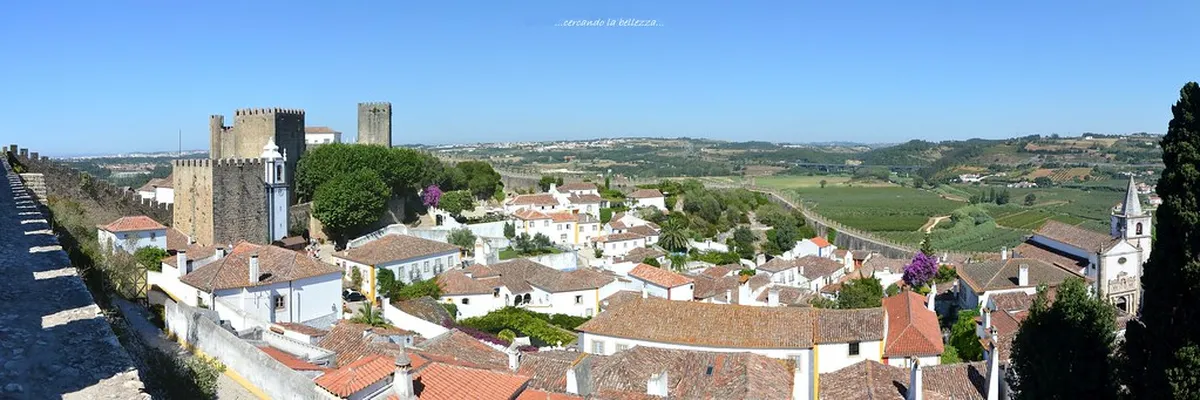
The castle building is used as a pousada. Treat the courtyard, lanes and defensive setting as the public experience unless a clearly advertised event or venue offers separate entry. The castle access guide separates free public space from paid museums and events.
Stop 6: Return via Side Streets and the Aqueduct
Return toward Porta da Vila through a different lane, then leave the walls and walk toward the visible Usseira aqueduct. Stay on pedestrian routes and do not climb or treat the monument's edges as a viewpoint. The aqueduct guide adds historical context.
Optional Wall Section
The ramparts are free to access but include narrow, exposed and largely unguarded sections. Skip them in rain, strong wind, poor light or uncomfortable crowds. Read the dedicated wall route and safety guide before deciding.
Frequently Asked Questions
How long does the walking tour take?
Allow two to three hours at ground level, plus time for open museums, shopping, food or a separate wall section.
Is there an official Óbidos map?
Yes. The municipality publishes a downloadable visitor map, linked in the official-sources section below.
Is the route accessible?
The ground-level route avoids the walls but still includes cobbles, slopes and possible steps. Ask the tourism office about the best live route for your mobility needs.
Does the castle require a ticket?
The castle building is a pousada. Museums, events and other venues may have their own tickets, but there is no single generic ticket for walking the village.
Official Sources to Check Before You Go
- Municipality of Óbidos official visitor map
- Óbidos Tourism official visitor information
- Óbidos Tourism Office location and hours
Transport, admission, event, weather and access details can change after publication. Recheck the source that affects your date instead of treating a copied schedule or price as permanent.